
Instagram navigation training
- Nav-Trek
- Jul 17, 2019
- 5 min read
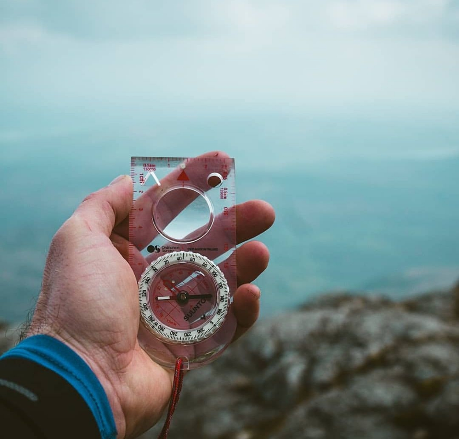
Have you ever come across a photo on Instagram or social media and been inspired enough to want to visit the location? I have! The first time for me was Winnats Pass in the Peak District. I had an incredible urge to go and see it for myself, and I did. But what we don’t often see on social media is the journey the photographer took to their location, nor what skills the individual had to get them there safely. More and more Mountain Rescue are displaying a trend of people getting into navigational difficulties trying to find a location that they have seen on social media. An Instagram story and post can get you to the summit of Scafell Pike in a matter of minutes, but in reality it has taken that person at least a couple of hours to get there, often over quite complex and dangerous terrain. This can lead a follower into a false sense of security as what it entails to reach the summit of Scafell Pike or any other mountain! With this in mind, and in partnership Ordnance Survey I recently ran two navigational workshops to help some social media friends gain the necessary skills to assess and plot routes to keep them safe in the mountains! I first put the call out on Instagram last November that I was planning on providing free navigation training to anyone interested in learning a new skill, or to refresh their existing knowledge. I was surprised by the interest and response that it received! A lot of those interested confessed to having little or no experience of using a map and compass, yet most of their social posts were of mountain scenery, or of them triumphantly posing by a summit trig point. Most admitted to using phone apps such as osmaps to navigate with. These apps are fine for 90% of the time but are no substitute for a good old paper map and compass. Batteries fail on electronic devices, a compass will not fail you, nor will a well looked after map! Mobile mapping apps are a great tool to give you a quick fix and to aid you in the right direction, I use them myself quite often, but you must not rely on them solely. A paper map and compass should be a part of your essential kit for each walk you do. The National Parks of Great Britain provide a network of recreational paths and footpaths throughout our mountains, and on a clear day you would be hard pushed to deploy your map and compass! Having said that, there will come a time when you do need to check the map, or to take a compass bearing to check that the path junction you are at is not going to lead you down into the opposite valley to that in which you started! Knowing you have the skill to be able to read a map and use a compass will seriously improve your day on the fells and give you the opportunity to explore off the beaten track so to speak. Provided with six Explorer maps and a compass to accompany each by Ordnance Survey, I selected six willing students and set off from a village near Ullswater into the mountains. It was early December and weather was not too kind to us at all, so we had to cut the day short for safety reasons. With a new date set for January 19th, our group of willing students had grown to eleven! We met in the same village of Hartsop and again headed up into the mountains in much better weather. As on the first course we started with an introduction to the map, and the different scales available. For the route I had chosen and for training purposes we would be using the 1:25000 explorer range. The explorer range of maps is so much better for teaching navigation as it contains twice the information than that of the 1:50000 landranger series. Once the team had an understanding of the map scale and the features we would use to navigate, we then set the map to the ground (orientated) so that the features in front of us on the map were also in front of us on the ground. We then concentrated on breaking our route down into navigational legs and looked for features we would pass to confirm our position (ticking off), such as streams, field boundaries, paths, and footbridges etc! The team were really starting to see the benefits of setting the map and identifying features as the ground opened up before them on the walk. After a quick coffee break it was time to introduce the compass into our game plan. We began to look for features on the map, measure the distance they were from us, and then take a bearing and walk to that feature. Again, to see the satisfaction on the teams faces as things clicked together and targets were found was hugely pleasing to see! We continued to work on the first 3 D`s of navigation Distance Direction Description So how far are we going, in what direction, and what is the ground doing between A and B? The team were soon finding targets for fun, and their confidence was growing from one checkpoint to the next! By the end of the day all eleven who joined the course were going away with a renewed confidence in their abilities and ready to take on new routes to put their new skills into practice. During the debrief in the pub I asked a few why they had come along and what they felt they got out of the day…. Phil “I had basic skills but was looking to gain more confidence to make my solo trips safer. I now have that confidence” Lucie “ I had a very basic awareness of navigation techniques but struggled to put them all together when needed! I now feel confident enough to read the terrain and to judge the distances I need to walk to find my objectives. I cannot wait to get back out and practice what I have learnt today” Dave “ I have previous experience but feel a little rusty and want to reassure myself that I still have those skills” Carl “ I can read a map but have never used a map and compass together. I now feel confident enough to start using them together on walks I am familiar with to gain more experience” Rose “ I am out in the fells a lot bagging Wainwrights but with no real knowledge on navigation, which makes me feel less confident when walking than I should be. I now feel confident that I have the skills and knowledge to navigate the fells, and I have also made new friends on the day” All in all it has been a great two workshops and everyone has gone away with the ability to navigate better. When they now see that banger shot on instagram, they will be able to plot a route to it with the confidence not to get lost in the mountains. It probably won’t increase their likes on Instagram? But it will keep them safe 😊 Thank you to all who attended…..Happy navigating


Comments